Carte du 18ème siècle avec des rivières, des arbres, le nom des villes, composition sur une sphère, comme une gravure noir et blanc, fond blanc


1 of 2
More Like This
Carte du 18ème siècle avec des rivières, des arbres, le nom des villes, composition sur une sphère, comme une gravure noir et blanc, fond blanc


1 of 2
Map of France, entire France, 18th century with rivers, trees, cities, like a black and white engraving, white background


1 of 2
18th century map with several villages, rivers of trees, names of cities, composition on a sphere, like a black and white engraving, white background


1 of 2
Map of France, entire 18th century France with rivers, trees, names of cities, like a black and white engraving, white background


1 of 2
Map of France, entire France, 18th century with rivers, trees, like a black and white engraving, white background


1 of 2
Map of France, entire 18th century France in a sphere, with rivers, trees, like a black and white engraving, white background


1 of 2
18th century map several villages, rivers of trees, composition on a sphere, like a black and white engraving, white background


1 of 2
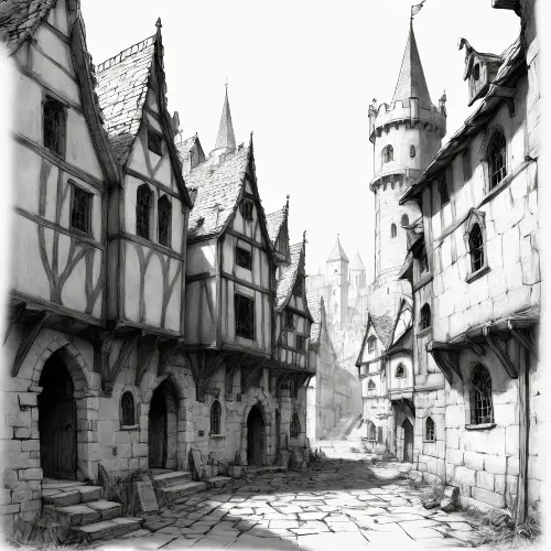
City map of the 18th century, with houses, trees, streams, composition, on a sphere like a planet, black and white, white background, engraving


1 of 2
Map of France, 18th century , black and white, water is blue, engraving


1 of 2
City map of the 18th century, several villages, with trees, rivers, mountains, composition, on a sphere like a planet, black and white, white background, engraving, no boats, the water is blue


1 of 2
map_of_the_18th_century_several_villages_with_trees_rivers_mountains_composition_on_a_sphere_like_a_planet_black_and_white_white_background_engraving


1 of 2
Map of the city of the 18th century several villages with trees of mountain rivers ,black and white without boats, water is blue, engraving


1 of 2


City map of the 18th century, several villages, with trees, rivers, mountains, black and white, white background, engraving, no boats, the water is blue.


1 of 2


18th century city map several villages with river trees, black and white without boats, water is blue, engraving


1 of 2


City map of the 18th century, untouched by rivers, several villages, with trees, rivers, mountains, black and white, white background, engraving, no boats, the water is blue.


1 of 2
18th century city map several villages with river trees, black and white without boats, water is blue, engraving


1 of 2
Map of Lyon, 18th century , black and white without boats, water is blue, engraving


1 of 2
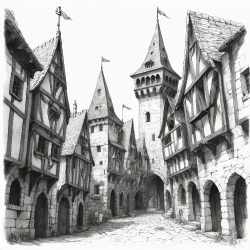
18th century city plan, with buildings, houses, trees, stream, composition, on a sphere like a planet


1 of 2
18th century city plan, with buildings, houses, trees, stream, composition, on a sphere like a planet


1 of 2
Cassini France map, 18th century, measuring instrument, cities, streams, rivers


1 of 2
Cassini France map, 18th century, measuring instrument, cities, streams, rivers


1 of 2
une salle avec une carte du monde contre un mur avec sur chaques pays un symbole qui le représente


1 of 2
genere une image avec dans le ciel, des cités qui flottent dans le ciel, verdoyantes, naturels, futuristes, dans des domes, avec couché de soleil. Et en bas de limage, dessine une ville détruite dans le noir


1 of 2
City plan of the 18th century, with, trees, stream, composition, on a sphere like a planet, black and white, white background, engraving, no boats, the water is blue


1 of 2
a ancient map on light brown parchment a solid gold gothic Victorian city with a clock tower in the middle,black and gold ink


1 of 2


sextant, ancient earth measuring tool, earth measuring instrument, on map of 18th century France, with rivers and roads, black and white, engraving, water is blue, background is white


1 of 2


A classical-style map featuring islands with yellow-green plains, light green mountain ranges, dark green mountain ranges, purple mountain ranges, deep blue mountain ranges, red volcanoes, brown volcanoes, snowy areas, sandy regions, rocky terrain, maple forests, and four black zones.


1 of 2
A classical-style map featuring islands with yellow-green plains, light green mountain ranges, dark green mountain ranges, purple mountain ranges, deep blue mountain ranges, red volcanoes, brown volcanoes, snowy areas, sandy regions, rocky terrain, maple forests, and four black zones.


1 of 2
A classical-style map featuring islands with yellow-green plains, light green mountain ranges, dark green mountain ranges, purple mountain ranges, deep blue mountain ranges, red volcanoes, brown volcanoes, snowy areas, sandy regions, rocky terrain, maple forests, and four black zones.


1 of 2
A classical-style map featuring islands with yellow-green plains, light green mountain ranges, dark green mountain ranges, purple mountain ranges, deep blue mountain ranges, red volcanoes, brown volcanoes, snowy areas, sandy regions, rocky terrain, maple forests, and four black zones.


1 of 2
A classical-style map featuring islands with yellow-green plains, light green mountain ranges, dark green mountain ranges, purple mountain ranges, deep blue mountain ranges, red volcanoes, brown volcanoes, snowy areas, sandy regions, rocky terrain, maple forests, and four black zones.


1 of 2
Un image d'un couché de soleil aux abords d'une ville, le style graphique est minimaliste, et j'aimerais que la couleur violet ressorte un peu


1 of 2

